World atlas & world map MxGeo 9.1.2
Free Version
Publisher Description
• Dark Mode Support
• Search for countries, cities, rivers, mountains, lakes or coordinates
• World Explorer: largest cities, longest rivers and highest mountains
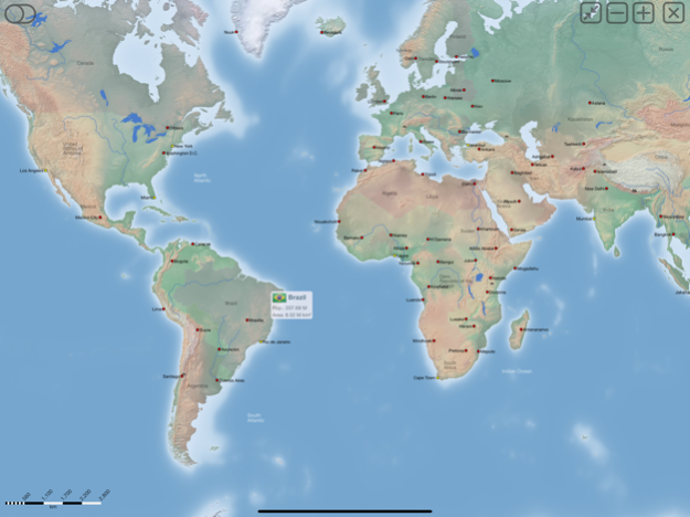
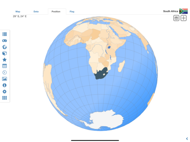
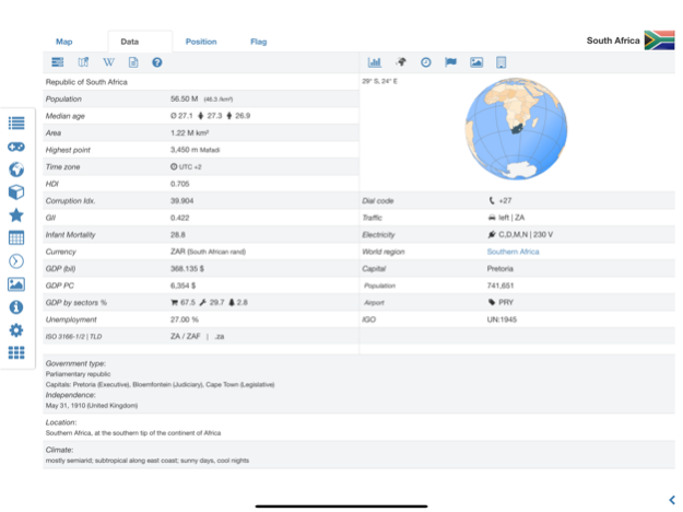
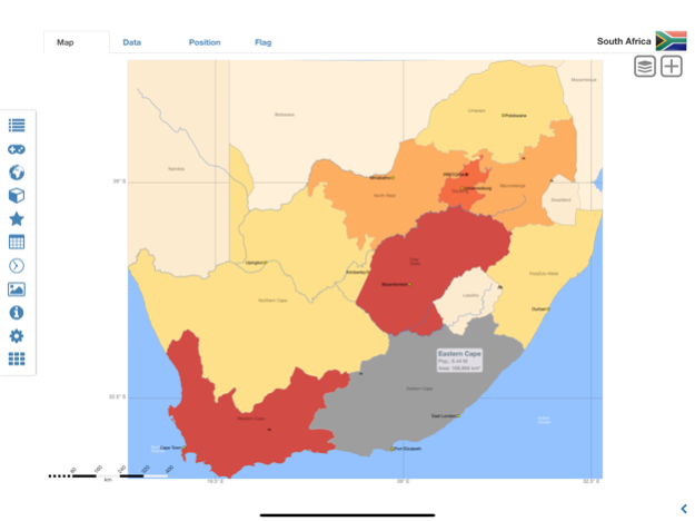
World atlas, world map and educational app for geography. Flags, position maps and basic data and basic maps with regional units for more than 260 countries and territories of the world. Detailed political maps and comprehensive economical and statistical country data for all African countries.
• Search for countries, major cities, rivers, deserts, lakes, mountains or coordinates
• Interactive political world and continent maps
• Flags, basic maps and basic data for over 260 countries and territories
• Shaded relief layer for world and continent maps
• Geography quiz: capitals, flags, federal states, ...
• Country comparison, favorite list and distance calculator
• World-explorer: the smallest, largest, ... countries, the largest cities, longest rivers and highest mountains
• Choropleth maps: area, population and HDI
• Political maps and comprehensive data of all african countries
• World clock and time zone map
• No advertising
Explore the world by political world and continent maps. Learn where each country in the world is located. View its position highlighted on a digital globe. Overview of the largest cities, longest rivers and highest mountains. Create your favorite color theme or choose from different color schemes for map display.
Do you know the flag of Zambia? Yes? Perfect. Do you also know in which country Mount Kilimanjaro is located? Increase your general geography knowledge in a playful manner. MxGeo Quiz: test your geographic literacy on various topics:
• Do you know the longest rivers?
• Federal states / provinces for selected countries
• Test your knowledge about the capitals of Africa
• Recognize the proper country flag based on the outline map
• Do you know the top-level domains of the world's countries?
• Guess the highlighted country on the virtual globe
• Guess the correct country based on the flag
• Do you know the ISO countries codes of the world?
• Do you know the mountains of Africa?
Geo learning app and educational game which is fun for everyone whether children, adults, seniors or teachers. Get ready for your next stay abroad while enjoying this great world almanac including time zones and statistical data, such as population growth and other key figures. Or prepare for your next geography lesson with this genius digital world map. If not traveling our world atlas lets you explore the world just only virtually.
Free version includes flags, position maps and basic data and basic maps for more than 260 countries and territories as well as comprehensive data and political maps for all African countries. Get “World atlas & world map MxGeo Pro” with data and maps for more than 260 countries and territories of the world: Europe, Asia, North America, Africa, Oceania and South America.
Jan 14, 2024
Version 9.1.2
• Updates for maps and data
• Bug fixes and improvements
• Enhanced chart visualization
8.x:
• New choropleth map: population density
• Country comparison and World Explorer new key indicator: population density
6.x:
• Search for countries, major cities, rivers, mountains, lakes and coordinates
• World Explorer: largest cities, longest rivers and highest mountains
• Distance calculator: cities, states, mountain, lakes, ...
5.x:
• Country info: government type, climate and date of independence
• Distance calculator: more cities
• Dynamic scale bars
About World atlas & world map MxGeo
World atlas & world map MxGeo is a free app for iOS published in the Kids list of apps, part of Education.
The company that develops World atlas & world map MxGeo is Hans-Peter Bahn. The latest version released by its developer is 9.1.2.
To install World atlas & world map MxGeo on your iOS device, just click the green Continue To App button above to start the installation process. The app is listed on our website since 2024-01-14 and was downloaded 24 times. We have already checked if the download link is safe, however for your own protection we recommend that you scan the downloaded app with your antivirus. Your antivirus may detect the World atlas & world map MxGeo as malware if the download link is broken.
How to install World atlas & world map MxGeo on your iOS device:
- Click on the Continue To App button on our website. This will redirect you to the App Store.
- Once the World atlas & world map MxGeo is shown in the iTunes listing of your iOS device, you can start its download and installation. Tap on the GET button to the right of the app to start downloading it.
- If you are not logged-in the iOS appstore app, you'll be prompted for your your Apple ID and/or password.
- After World atlas & world map MxGeo is downloaded, you'll see an INSTALL button to the right. Tap on it to start the actual installation of the iOS app.
- Once installation is finished you can tap on the OPEN button to start it. Its icon will also be added to your device home screen.
